Trona Pinnacles Field Trip
Have you ever been dragged to a place you didn't want to go?.. But once you are there, you thank whoever dragged you out of bed, on the weekend, at 5:00 am in the morning because you discover this place is like magic!!.. What? for how long was I asleep? are we still in California? Are we in the same planet?... Oh no, we've been abducted by Aliens and dropped us on a distant planet?... No silly, this is still California, we're close to Ridgecrest. Oh, well! Thank you Hun for bringing us here.
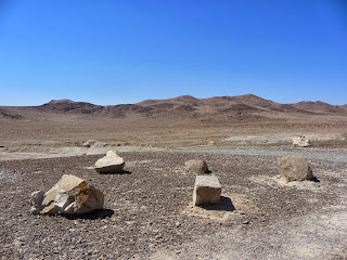
This was a pretty amazing trip, one I didn't expect. When we got there the Trona Pinnacles look so majestic. I didn't know much about them then but I did a little research an this is what I found. First, these are some of our pictures from our trip.
My son and I
My husband Ramon and Ramon Jr.
According to the DesertUSA (www.desertusa.com)- The unique rock formation were created about 10,000 years ago when Searles Lake formed a link in a chain of interconnected lakes throughout the Owens Valley and the Mojave Desert, At its peak, due to glacial runoff form the Sierra Nevada Mountains to the west, Searles Lake reached a depth of 640 feet and overflowed into Panamit Valley and Death Valley.
The tufa pinnacles formed underwater through the interaction of blue-green algae and local chemicals and geothermal conditions. As the regional climate cool and the glaciers disappeared, the trapped water of Searles Lake became rich in carbonate brine. Calcium-rich underground hot springs welled up through fault line fractures on the lake bottom, forming calcium carbonate deposits. Colonies of blue-green algae then bonded to these deposits and, over several thousands years, formed tufa reefs. The unusual landscape consist of more than 500 tufa spires, some as high as 140 feet, rising fro the bed of the Searles Dry Lake basin. When Searles Lake dried up completely, the Trona Pinnacles remained.
Because of the site's significance as one of the most outstanding examples of tufa features in North America, the Trona Pinnacles were designated a National Natural Landmark in 1968 by the U.S. Department of Interior.
According to the BLM (US Bureau of Land Management)- Geologically the pinnacles are classified in four general shapes:
* Towers - they are taller that they are wide and rise 30 to 40 feet. Look for pointed, rounded, or flat summits.
* Tombstones - are stubby and squat and rise 20 to 30 feet.
*Ridges - are massive, toothy and tufa runs. Trona Pinnacles has three ridges. One ridge is 800 feet long, 500 feet wide and 140 feet tall.
*Cones - are less than 10 feet tall. Dumpy and mounded cones shapes lay scattered throughout the Trona Pinnacles.
Somewhere between the rock formation there is a sign about the Trona Pinnacles. It reads as follows:
National Natural Landmark and Area of Critical Environmental Concern
Consisting of over 500 spires, some as high as 140 feet, the Trona Pinnacles are the most outstanding examples of tufa (porous rock formed as a deposit from springs of streams) in North America. These exotic examples appearing rock formations are relics of the glacial periods during which the valleys of this area were filled with water and formed a great chain of interconnected lakes. The area received water from the Owens River and occasionally overflowed to the south, east and north.
The Pinnacles themselves, which vary size and shape from short and squat to tall and thin, are composed primarily of calcium carbonate and rise dramatically contrasted against the flat lake bottom, has been frequently, and appropriately, described as a landscape from another world.
Administered by the Bureau of Land Management.
Notes on getting There
The Trona Pinnacles are located 20 miles east of Ridgecrest, California. They are accessible via a dirt road that intersects with California Route 178, more less 7 1/2 miles south of the town of Trona. We took my husband's service truck, but I think any car would be able to drive through it. Spring and Fall is the best time to visit since in the Summer it gets real hot.
I have heard people say the sunrise and sunset are spectacular!! We have yet to experience that. Maybe soon! I hope you all enjoy it one day as well.
This is it for now folks!!
Bea :)
References:
1. Deser USA - www.desertusa.com. 1996-2013
2. U. S. Bureau of Land Management.


No comments:
Post a Comment